By popular demand! a series of maps showing some of the historic locations with Mellor parish boundary.
I will add more over time, but please feel free to comment or correct.
( * * * * THIS WILL SOON BE UPDATED AND AVAILABLE IN BOOK FORMAT * * * *)
Mills

Coal Mines

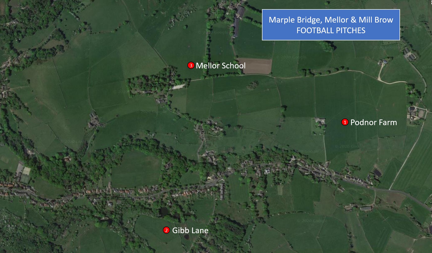
Football pitches
Pubs present and past

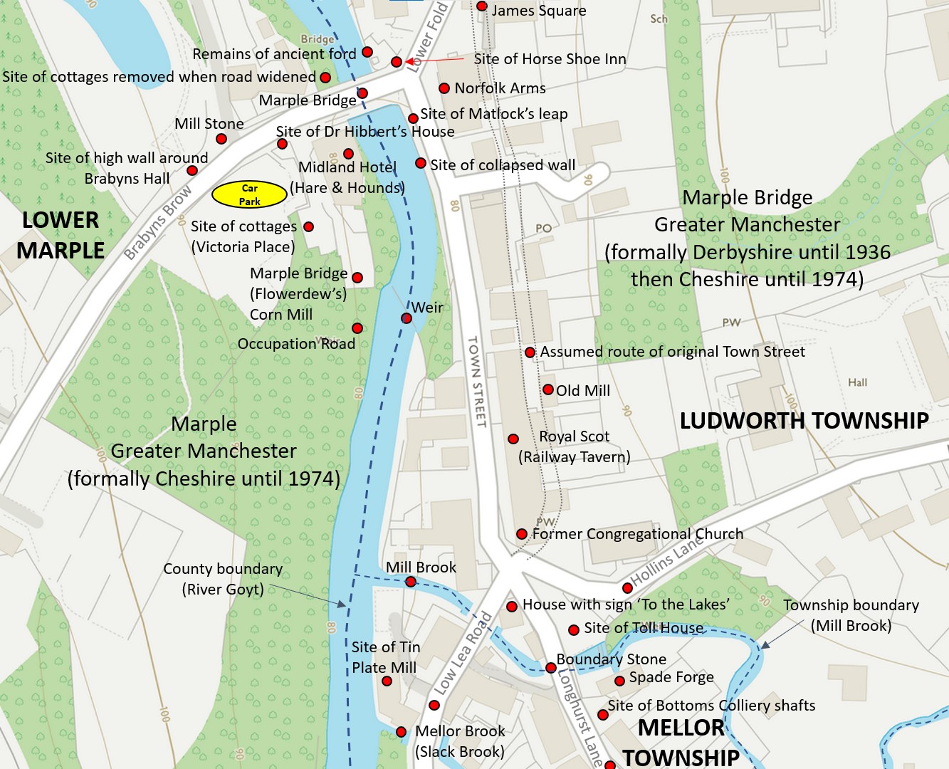
Marple Bridge historical sites
Links
Ludworth Moor Colliery
https://pleszak.blog/2021/12/13/ludworth-moor-colliery/
Rod Thackray paintings
https://pleszak.blog/2021/11/13/rod-thackray-paintings-n-e-w/
Oldknow’s Seat
https://pleszak.blog/2021/08/18/oldknows-seat/
MELLOR – A TALE OF THREE GOLF CLUBS
https://pleszak.blog/2020/04/07/mellor-a-tale-of-three-golf-clubs/
Mellor Church: Poems & Paintings
https://pleszak.blog/2020/01/23/mellor-church-poems/

2 thoughts on “Mellor History Maps”